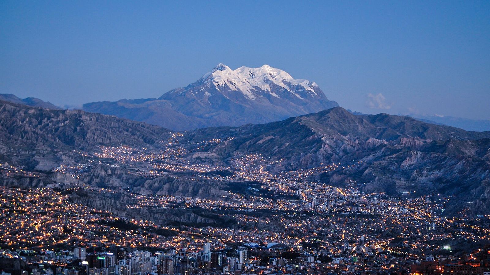
La Paz is easy to stay connected in, which surprises people who have read about the altitude and assumed the infrastructure matches. All three Bolivian networks blanket the canyon, 4G is quick enough for video calls from most of it, and the cable car system that stitches the city together has clear line of sight to half the masts in the valley. The complication is not signal, it is geometry: this is a city with roughly 900 metres of vertical between the El Alto rim at over 4,000 metres and the Zona Sur floor around 3,250, and the neighbourhoods along that drop feel different in temperature, in air, and occasionally in how well your phone holds a bar. Everything genuinely difficult about connectivity in Bolivia starts once you leave the city limits.
What This Guide Covers
Jump to the section most relevant to you
How Coverage Behaves Across the Canyon
La Paz is served by Entel, Tigo and Viva, and inside the city the practical differences between them are small. Tigo tends to be the quickest on a speed test in the denser central districts, Entel is the one you will still be talking on when you drive out of town, and Viva is competent in the middle and thin at the edges. A travel eSIM will put you on Viva if it is Airalo, and on Tigo if it is Nomad or Holafly. For a city stay, either is fine.
Where the terrain does assert itself is in the older, steeper parts of the centre. The lanes climbing away from Plaza Murillo, the cobbled slope of Calle Jaen, and the tight stretch of Sagarnaga above the Mercado de las Brujas all sit in stone canyons of their own making, and you can lose a bar or two walking twenty metres uphill. The same is true in the deeper side valleys behind Achumani and in parts of the Obrajes descent, where the road hugs one wall and the masts are on the other. None of this is a coverage failure, it is shadowing, and it resolves as soon as you are back on an open street.
Altitude does not weaken your signal
A recurring worry among first-time visitors is that thin air somehow degrades mobile reception. It does not. If anything the opposite applies here, because a city stacked on a slope gives base stations unusually good sightlines across the bowl. What altitude does affect is you: the first day at 3,600 metres leaves most people slow, headachy and disinclined to troubleshoot anything technical, which is the real reason to have your connection working before you arrive rather than after.
El Alto, the vast city on the rim above, is a separate municipality and is covered just as thoroughly, though speeds around the Ceja and the 16 de Julio market area sag noticeably on Thursdays and Sundays when the market fills the streets with several hundred thousand people and their phones.
Data on Mi Teleferico, the Cable Car Network
La Paz does not have a metro. It has ten colour-coded cable car lines that function as one, carrying commuters up and down a gradient no bus route could reasonably manage, and for a visitor it is both the best transport and the best viewing platform in the city. It is also, unexpectedly, one of the most reliable places in La Paz to make a call, because a glass cabin suspended above the canyon has an uninterrupted view of everything.
| Line | Route | Journey | Why you would ride it |
|---|---|---|---|
| Roja (Red) | Estacion Central to Cementerio to 16 de Julio | About 11 min | The original line, and the direct link from the centre up to El Alto |
| Amarilla (Yellow) | Mirador to Buenos Aires to Sopocachi to Libertador | About 17 min | The spectacular one, dropping off the rim straight over the canyon |
| Verde (Green) | Libertador to Alto Obrajes to Obrajes to Irpavi | About 16 min | The way down into the Zona Sur without sitting in traffic |
| Plateada (Silver) | 16 de Julio to Faro Murillo to Mirador | About 12 min | Connects the two El Alto termini so you can loop back |
Fares in 2026 are Bs 3 for the first line and Bs 2 for each transfer, with a reduced rate of Bs 1.50 plus Bs 1 for students, over-sixties and passengers with disabilities. There is also a circular ticket at Bs 11 that gives you access to six lines, which is the cheapest sightseeing in South America by some margin. Buy at the station window; the machines take coins and small notes.
Riding the Amarilla and Verde end to end
Chaining the Yellow line down from El Alto to Libertador and then the Green line onward to Irpavi takes you from the highest point of the city to the lowest in around half an hour for Bs 5. Coverage holds the entire way, so you can stream, navigate or take a call across the whole descent. It is also the single best way to understand the shape of La Paz before you start walking around in it.
Sopocachi, San Pedro and Miraflores in Practice
Where you stay changes your day here more than in most cities, because the altitude difference between districts is large enough to affect how you sleep.
Sopocachi
The bohemian middle band of the city, built around Plaza Avaroa, full of restaurants, bars, galleries and the closest thing La Paz has to a remote-working scene. Coverage is strong and the cafe density means there is always a fallback network within a block. If you are here to work for a week, this is where to base yourself, and the Yellow line has a station on its edge at Libertador.
San Pedro
Wedged between the centre and Sopocachi, still largely a working neighbourhood of hardware shops and car parts dealers rather than a tourist quarter, arranged around the plaza and the imposing bulk of the old prison. Signal is fine on the plaza and in the through streets, patchier in the tightest uphill lanes. It is cheaper to stay in than Sopocachi and closer to the centre than Miraflores.
Miraflores
Residential, laid out along Avenida Busch, home to the Hernando Siles stadium and the botanical garden, and flatter underfoot than almost anywhere else in La Paz, which matters more than you would think while you are acclimatising. Coverage is uniformly good. It is quieter at night than Sopocachi and has fewer places to eat, which is either the point or the problem depending on your trip.
Then there are the two ends of the vertical. The Centro, around Plaza Murillo, El Prado and the tourist streets of Sagarnaga, is where the museums and the markets are and where the signal shadowing is most noticeable. The Zona Sur, meaning Calacoto, San Miguel, Achumani and Irpavi, sits several hundred metres lower, is measurably warmer, has the malls and the best restaurants, and is where people who can afford to choose tend to live. Coverage down there is excellent and the air is easier, but you are a long way from the historic city and traffic on the way back up can be grim, which is exactly the argument for the Green line.
The Truth About WiFi in La Paz
There is no dependable city-wide free network in La Paz, and you should not plan around finding one. What exists instead is a patchwork of private connections of wildly varying quality, which is why a working mobile plan matters more here than in a city with a municipal WiFi programme.
- Hotels and hostels. Genuinely a lottery. The signal is often decent in the lobby and weak by the time it reaches a room two floors up through thick adobe or brick walls. Recent guest reviews are a better guide than the property's own description, and it is worth asking for a room near the router if you are working.
- Cafes in Sopocachi and San Miguel. The most reliable public option, and the reason both districts have become default working spots. Expect to buy something, expect the password to be on the receipt, and expect it to be adequate rather than fast.
- Coworking spaces. A handful operate in Sopocachi and the Zona Sur, with day passes available. If you have a week of real work, this is the only way to guarantee a connection that will hold a long video call.
- Restaurants and malls in the Zona Sur. Generally the fastest fixed connections in the city, because the fibre build is better down there.
Why your own data is the sensible default
La Paz is a city you navigate on foot and by cable car, across a gradient that makes wrong turns expensive in effort. Standing at a junction on the Prado trying to remember which way Sagarnaga runs, with no signal because the cafe you were in is now a block behind you, is a specifically unpleasant way to be at 3,600 metres. Mobile data here is cheap enough on a local pack and available enough on an eSIM that going without it is a false economy.
Getting Online When You Arrive
Almost everyone flying in lands at El Alto International, on the plateau above the city, and the first hour is worth planning because it is the hour you will be least capable of improvising.
Sort the profile at home
Add the eSIM to your phone while you still have a connection you trust, and confirm it appears in your cellular settings as a second line. Doing this once, calmly, at your kitchen table is worth a great deal more than doing it in an arrivals hall where the air has a third less oxygen in it.
Turn it on before you leave the terminal
Enable the line and set it as your data line while you are still inside, where the airport's own connection can bail you out if something needs downloading. Open a map and confirm you have a fix before you walk out to the taxi rank.
Take a radio taxi down, at least on day one
The run from the airport into central La Paz is 13 km and around 30 to 40 minutes on the autopista, generally Bs 80 to 120. Agree the fare before you get in. The minibus and cable car combination is cheaper and perfectly usable later in the trip, but not with luggage and unacclimatised lungs on your first afternoon.
Deal with the local SIM on day two
If you want an Entel or Tigo card, there are branded stores along El Prado and in San Miguel that will register it properly. Going the following morning rather than straight off the plane costs you nothing and spares you a queue while your head is pounding.
One practical note on the descent: the road drops roughly 400 metres from the rim to the city in a few kilometres, and the view as you come over the lip is one of the great arrivals anywhere. Coverage holds the whole way, so if you want to send the photograph immediately, you can.
Day Trips: Where the Signal Runs Out
La Paz is a base as much as a destination, and the excursions people take from it vary enormously in how connected they leave you. This is the part of a Bolivian trip where the choice of network genuinely matters.
| Trip | Distance | Coverage | Notes |
|---|---|---|---|
| Tiwanaku | About 72 km west | Good | Open altiplano the whole way with settlements along the road, so Entel holds well and Tigo is usually present at the site itself. |
| Valle de la Luna | 10 km, Zona Sur | Good | Effectively still in the city, below Mallasa. Signal is fine throughout the eroded spires and along the Rio Abajo road. |
| Chacaltaya | About 35 km north | Variable | Above 5,000 metres with sightlines toward El Alto, so it can be surprisingly good at the top and absent on the switchbacks below. |
| North Yungas Road | To Coroico, 3 to 5 hrs | Unreliable | Coverage flickers in and out on the descent through the cloud forest. Not something to navigate by, on any network. |
| Copacabana | About 155 km, 3.5 hrs | Good in town | Solid around the basilica and the beach, including the Tiquina ferry crossing. Isla del Sol is thin, mostly on the high path. |
The pattern is consistent across all of them: anywhere with a village has a mast, and anywhere between villages may not. For the Yungas descent in particular, download offline maps of the route before you leave La Paz, and if you are riding it, agree a meeting point with your group rather than assuming you can call anyone. If your Bolivian itinerary is heavy on this kind of excursion, that is the argument for putting a local Entel card in the phone once you are settled, because the two networks the travel eSIMs ride are both built for cities rather than for the road to Coroico.
Frequently Asked Questions
Does my phone keep a signal inside the cable car cabins?
Yes, and better than at street level. Mi Teleferico cabins are glass boxes hanging above the canyon with clear line of sight to masts across the whole bowl, so calls and streaming hold up for the entire ride. The Yellow line down from El Alto and the Green line into the Zona Sur both work end to end. The only brief interruptions are inside the stations themselves during a transfer, and those last seconds rather than minutes.
Is the altitude in La Paz going to affect my mobile data?
No. Thin air has no meaningful effect on radio propagation at these distances, and a city built on a slope actually gives base stations better sightlines than a flat one. What altitude affects is the person holding the phone. Most visitors spend the first 24 to 48 hours slow and headachy at 3,600 metres, which is a strong practical reason to arrive with a working connection already set up rather than planning to sort it out in an arrivals hall.
Where should I stay in La Paz if I need to work online?
Sopocachi is the usual answer. It has the highest concentration of cafes with usable connections, a couple of coworking spaces with day passes, and it sits mid-canyon so it is neither as cold as the rim nor as far out as the Zona Sur. San Miguel in the Zona Sur is the alternative if you want the best fixed broadband and warmer nights, at the cost of being a long way from the historic centre. In either case, assume the hotel WiFi is a bonus rather than a plan and keep a mobile data allowance in reserve.
How much does it cost to get from the airport into the city?
A radio taxi from El Alto International into central La Paz is generally Bs 80 to 120, roughly seven to ten dollars at September 2026 rates, and takes 30 to 40 minutes on the autopista, faster late at night. Agree the price before you get in, because the fare is negotiated rather than metered. The cheap alternative is a minibus into El Alto plus the cable car down, at Bs 3 for the first line and Bs 2 per transfer, but it is not a sensible first move with luggage while you are still adjusting to the altitude.
Which network should I be on for day trips out of La Paz?
Entel, if you have the choice. It is the state carrier and the one most likely to have built in the small places along the roads to Tiwanaku, Coroico and Copacabana. The complication is that no travel eSIM sells Entel access: Airalo runs through Viva and both Nomad and Holafly run through Tigo, all of which are stronger in cities than on the altiplano. For a city-based stay the eSIM is fine, and for an excursion-heavy trip it is worth adding a local Entel card once you have acclimatised.